STANSTEAD – AN ABANDONED VILLAGE?
by Ron Dale
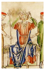
Harold Godwinson
In September, 1066, peasants of our ancient village would have been busy working the land we still tread today. According to the Domesday Survey of 20 years later there were 36 households in the manor which could be estimated to a population of about 120 to 150 people, plus we had a priest and two slaves. We now know that the church of St. James at Stanstead Bury was commenced circa 1060, although it was a much smaller church than now. The font is 13th century on a 15th century pedestal and as only parish churches could perform baptisms, we know this was our local parish church at that time. But where was the parish? Because of the Roman site of Stanstead Bury and the location there of the church, we must assume that a community would live nearby. We can never know the location of these 36 households, although we do know that some houses existed on the Easneye estate as Sir Simon de Stanstede lived in the 12th century in a house in Alwine’s Frith on the high plain above Little Briggens Farm (According to The Early Charters of Waltham Abbey). As this area bears the name of our Saxon lord Alwine Gottone, he also may have lived there; he certainly owned it as did the later Norman manorial lords.
On 25th September the recently crowned King Harold had just defeated the Norwegian
Vikings at Stamford Bridge in Yorkshire in their bid to take the throne. Some of
our local villagers may have been recruited for this battle as Harold’s base at Waltham
Holy Cross is only a few miles away and this was his land. He and his battle-
Stanestede is the village name in the Domesday Book, meaning a place of stones,
probably due to the widespread gravel deposits. In the 12th century when the village
passed into the hands of the abbot of Waltham Abbey, property transfers in subsequent
charters were in Latin and there we became Stanstede Abbatis, or in English, Stanstead
Abbotts. The problem facing local historians today is that villages were rarely featured
on early maps and we have no way of knowing if there was a settlement of some kind
at Stanstead Bury, in addition to the church and possibly a large house, the forerunner
of the manor house we know today. However common-
Stanstead Abbotts is recorded in two books listing abandoned medieval villages of Hertfordshire. No specific reason is given for individual villages being abandoned, but a list of reasons is offered. Climate change is one reason, where horrendous crop failures caused people to leave the land and gravitate towards larger towns for alternative employment. Another good reason was the spate of plagues which decimated the population severely in the 14th century, sometimes wiping out half the population.
The evidence for some kind of settlement near the church is strong. In spite
of this, local historians do not all agree on the existence of an ancient village
up on the hilltops a mile or so distant from the modern High Street. There is no
archaeological evidence of an early hamlet at Stanstead Bury, mainly due to the widespread
gravel diggings which have been done in the fields between Stanstead Bury and Roydon
village. On the other hand, we do not have any idea when the first houses appeared
on our High Street. There is to-
The safe building of High Street property depended on the conduct of the river Lea. Personally, I feel that most people would avoid living in areas liable to regular flooding – and our river has a reputation for doing this and even more so in past centuries. I do not believe that any housing appeared at the riverside of our High Street until about the 16th century. Improvements to the river flooding have been ongoing for centuries but the High Street is still a little affected even today. We have no facts to show the date when houses first appeared in our High Street. Additionally there are several small streams which still flow under the High Street and which occasionally remind us of their presence by bursting through the tarmac. The very detailed Tithe Map of 1840 shows these, but in 1066 we do not know where the course of the river flowed.
The Domesday Survey of 1086 shows that the Stanestede entry was divided into four sections. The facts are interesting and helpful in our quest:
1. Taxable value 17.5 geld units (about 17.5 hides) Payment to lord 1066 £20. In 1086 £17. Woodland for 100 pigs, 16 ploughlands, 2 lord’s ploughlands.
30 households, 4 Villagers, 2 slaves, 1 priest (named as Peter on another translation), 5 cottagers, 5 others (foreigners), 7 burgesses.
Lords in 1066: Alwine Gottone, Eskil of Ware, Lords in 1086: Ranulf, brother of Ilger,
Tenant-
2. 4 households: Ploughlands 0.89, woodland for 8 pigs. Lord in 1066 Gothmund,
Overlord King Edward. Tenant in Chief-
3. 0.5 geld unit (another small area of land, about half a hide. 1 household,
1 Cottager (un-
4. 0.1 geld unit (about one tenth hide), meadow and woodland for one pig! Lord
in 1066 1 Freeman (un-
ALWINE GOTTONE
The Saxon lord of Stanestede was Alwine Gottone, with various spellings (Alwin, Godtone
etc.) As can be seen in the Domesday Survey, he did not own all the land, but he
also held Roydon, Nazeing, Hunsdon, North Weald, Ayot St. Lawrence, Harlow and Great
Parndon. As there were several thegns called Alwine in the Domesday Book, his name
is always linked to the words Gottone or Godtone. I have searched most ancient languages
and place names, but have been unsuccessful in discovering the meaning of this word
describing our Alwine. However, I did find one reference to it which claims it to
be a synonym of the word Goth. No citation was given for this, however. One subculture
of the Goths survived as late as the 18th century in the area of Crimea, but most
were early absorbed, either by the Roman Empire or the Huns. Alwine’s Frith is discussed
elsewhere on this web-
RANULF, BROTHER OF ILGER
The first Norman lord of Stanestede was Ranulf, brother of Ilger. Unfortunately we know very little about him. He was an important thegn of William the Conqueror with many estates in the South East including manors in Hertfordshire, Essex, Huntingdonshire, Bedfordshire, Cambridgeshire, Suffolk and Norfolk. Because there were several Norman knights named Ranulf, he was identified by his brother’s name, Ilger, who was the tutor of King William’s son Robert, thus making identification easier (Ranulf frater Ilgeri). It is not known with certainty where Ranulf had his caput (seat) as his estates were very widespread, but he did have a cluster near each other in our locality and in nearby Essex taken over from Alwine. This suggests that Stanstead, being the largest manor at the time, could have been his caput. Additionally his wife was the niece of Ralph Taillebois, once lord of Hunsdon, who brought with her dowry a parcel of land in Hunsdon. Ranulf was Sheriff of Huntingdonshire from 1092 to his death in 1100. As he is mentioned as having 88 estates in the Domesday Book, he must have been a man of considerable wealth.
When I was a young boy at school we learnt of the brave warrior, Earl Harold
Godwinson, popular with all who knew him and second to Robin Hood, he became my childhood
hero. When I learnt that William of Normandy was responsible for Harold’s death and
the theft of his kingdom, I never forgave him for this. Still haven’t. We do, however,
have William to thank for arranging the 1086 Survey. Of course it was formulated
purely for taxation purposes, but it did leave behind for all generations a record
of people and places which is invaluable today. Sadly, only the land-
The Domesday Survey does help the question of a hilltop settlement in one respect.
In my opinion the 30 households of section 1 of the survey suggest a settlement of
this size at or near Stanstead Bury, but this is only an opinion. The record
shows section 1 was owned by the Saxon lord Alwine and Askil of Ware, so this section
could also include land adjacent to Ware at Easneye, where we know Alwine had property.
(Alwine’s Frith). We must also remember that in this section Peter the priest was
included as a resident, plus the two slaves. These slaves would have been owned by
a high-
It would appear from a close examination of these facts that a settlement of some kind must have existed fairly close to the church at Stanstead Bury, and the thirty households in section one of the Domesday Survey may include some in the area of Cats Hill and Netherfield, together with Easneye. Conversely we can see that an industry was bound to develop at the riverside from the 12th century once the bridge was built. We also know and have many records of river improvements ongoing from the 14th century, a time when many locals died of the plague. Gradually the hilltop community would shrink for various reasons, possibly also including crop failures and the development of malting in the valley offering a more reliable income. And as this transfer of employment continued, we would find the residents of Stanstead Abbotts now mainly living a mile or so away from its church. Additionally we also know that a chapel was built in Cappell Lane in the 13th century, which endowed the road with its name and the 16th century Grammar School (now the Clock House) was utilised as a chapel after this earlier chapel was demolished (See Manorial Court at Stanstead Bury on this site). Both these facts point to an attempt to avoid the arduous trek uphill to St. James church by residents compelled by law to attend church or face a fine and who were already living in the valley (Cappell Lane) or at Easneye, but still away from the riverside. The dissipation of the 30 households of Section 1 was obviously gradual and I can see no need of any disagreement between opposing opinions as both sides are in many ways correct. The only dispute is a matter of dates, and neither side has proof of these: impasse.
******
Here are some names of early fields and parts of the village mentioned in 13th century documents from Waltham Abbey and other charters. In spite of the fact that it is impossible to locate the sites of these fields, we must retain their names for posterity:
Danesthemanewode, Sturtereshull, New Strate (possibly part of Cappell Lane), Beckebergfelde (field with a stream on a hill), Kings Feld (King’s Field), Alfeydesholme, Alvevesholm, Hascholm. [Note: The Swedish word holm means river island (as in Stockholm) or a place near water liable to flooding.
(Domesday Survey details from the latest translation Open Domesday site of Anna Powell Smith, translated by Professor J. J. N. Palmer, University of Hull, Yorkshire.)
Ron Dale, March, 2017.